
SCOTTISH HIGHLANDS: Ben Lomond: Aug 13th
Regular price
£45.00
£55.00
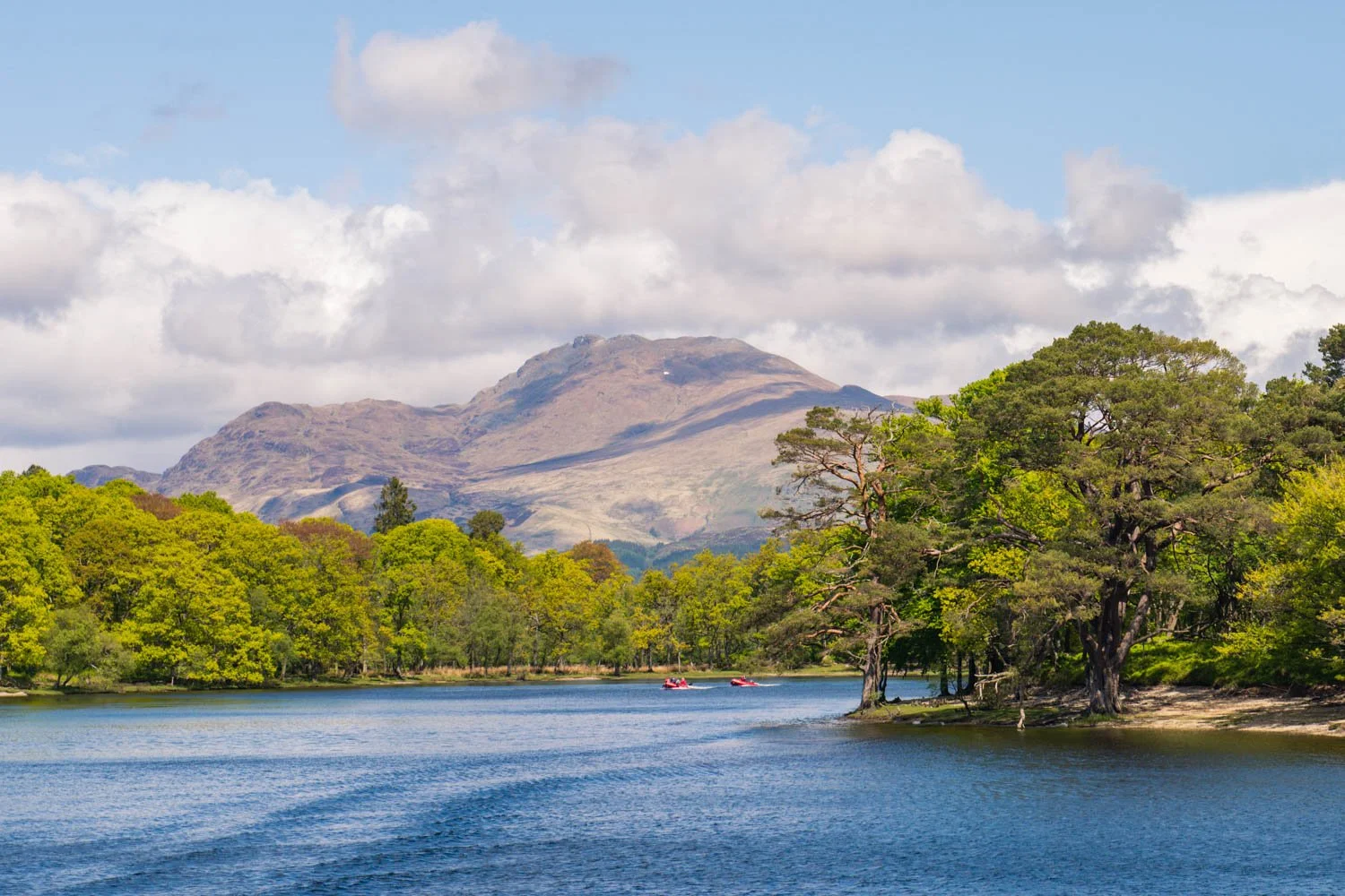
The view over Loch Lomond!
Ben Lomond is one of the most popular Munros, rewarding the 30,000 people who make it to the top with truly fantastic views of the length of Loch Lomond and its islands. The view to the north reveals range beyond range of mountains into the Highlands. The path up is well made, but the optional return down the Ptarmigan ridge is steep and rocky, and muddy lower down.

SCHEDULE
(approximate timings dependent on hiker pace at weather timing)
10:00 Meet Rowardennan car park.
10:15 Start Hike
13:30 Ben Lomond summit reached
15:30 Expected Finish
18:00 Dinner Celebration
We only regret opportunities we don't take

Signing Up
Please read our terms and conditions before signing up, including the cancellation policy.
Once entered, please complete our applicant H&S form, so we know how best to look after you on the event and to finalise your place.
Accommodation & Transport
These are not included for this event booking. However please join the event WhatsApp group to discuss travel and accommodation sharing with other participants by linking the joining link: HIGHLANDS WhatsApp group - click here to join
If you do not wish to drive, trains, even an overnight sleeper, can be booked to Fort William station.
Please book accommodation early, as this is a very popular area, where prices are often high late on. Booking.com and Airbnb are great places to start.
Additional Help
If you would like some expert accommodation advice we recommend contacting:
laura.wheeler@email.travelcounsellors.co.uk
IMPORTANT INFO
- A WHATSAPP group will be created to share info and photos on the day. In signing up to the event you are agreeing to be added to this group, which will contain other participants. This is necessary so that details can be shared in the run up to the event, including last minute changes, reminders or cancellations.
- Charity involvement: many of our walks are being run in partnership with charities. As such, sign up information is shared with the charity involved for the purpose of running the event and communicating its purpose, which is to help raise awareness and funds for the charity. By signing up, you are agreeing to receive information from Get Outdoors and the charity.
- Booking Terms & Conditions (Including cancellation policy): are found here. PLEASE READ BEFORE MAKING A BOOKING.
- Kit: Packed lunches, walking boots, multiple layers and waterproofs (including trousers!) are essential. The weather could be very cold and wet. Please visit our recommended kit list.
- While on the walk: we ask you to remain with the group and following instructions from Get Outdoors leader(s), who have the final decision in all instances.
- Parking Charges: may apply. Good idea to bring cash/change.
- Problems: on the day call Chris: 07885157903
- Dogs: are welcome on the walks, but are entirely the owner's responsibility, must have a lead and be under close control at all times. Please check your accommodation's policy.
- Livestock: If encountered do not walk too close or get between a cow and calf. If threatened, let go of your dog so it can escape and reduce the risk to yourself.
- Public rights of way: please keep to them and respect the landowner’s property at all times.
- Stiles: are often present on the route to negotiate on this type of walk.
- Countryside walking: can often include hills and uneven terrain. Our group ethos is to support everyone in group to achieve their maximum potential in terms of completing the route. As such, we endeavour to walk at a pace all participants are comfortable with. We apologise if this causes any frustration to fitter walkers.
- Health: please consult your doctor if you are at all worried about your fitness and ability to take part. Please inform the walk leaders, Get Outdoors, of any underlying health conditions that may affect your walking ability before signing.
Health & Safety Application Form:
If you have not already (or if circumstances have changed), please complete the participant health & safety form at this link, so we know how best to look after you.

Weather:
Hill and mountain walking can be hazardous! Not being prepared for rapidly changing weather conditions can lead to over exposure or heat stroke. Layers are key, allowing you to easily adjust your level of warmth. We are likely to experience some nasty weather, so for your safe enjoyment please bring the items specified on the kit list:
MOUNTAIN KIT LIST
Tried and tested clothing only
Only pack items needed for walking
- Rucksack - min 25 litres with cover.
- Walking boots; broken in; NO trainers
- Double layer walking socks.
- Waterproof jacket & trousers.
- Base layer top – breathable.
- Warm fleece and spare fleece.
- Walking trousers - NO jeans!
- Multiple thin tops allowing temperature changes.
- Post-challenge clothes.
- 3 litres of fluid per peak.
- Basic First Aid kit & Sun cream.
- Warm gloves, hat/balaclava.
- Head torch with spare batteries.
- Whistle for sounding the alarm.
- Toiletries, towel.
- Mobile phone & waterproof case
- FULL LIST HERE

Training & Fitness:
As a rough guide we recommend vigorous exercise at least 3 times per week for as long as you can prior to the event. Walk briskly on the hilliest routes you can find, such that you are regularly out of breath. Improve your stamina by including a long weekly walk, building up to 10 miles or more. Improve your cardio by walking your shorter walks as fast as you can.
Jogging uphill is a really good way to replicate the cardiovascular strain of walking up a steep mountain and a great way to pack in some intense last-minute training if you are feeling a bit behind.
Strength and condition exercise, such as weight training or Pilates are beneficial for working on your leg power and core strength.
However you can't truly replicate the relentlessness of a steep mountain incline. Great places to train with decent inclines include: The Lake District with 214 Wainwrights; Snowdonia has 14 Peaks over 3,000ft; The Dark Peak District with Mam Tor, the Great Ridge and Kinder Scout; the Brecon Beacons & Black Mountains with Pen y Fan and Sugar Loaf Mountains. There are also the Malvern Hills, Chiltern Hills and Cotswolds, which have lots of hilly walks. There may be other hilly areas near you.
Finally and most importantly, make sure you take it easy during the last week running up to the event. All top athletes do it - 'Tapering off' is your opportunity to exercise lightly and make sure you do not arrive with a build up of lactic acid in your legs that will slow you down during the challenge.
Food & Drink
Walkers are expected to bring all of the food they need for the walk. Please pack a substantial lunch as you will be walking for a long day. Also plenty of snacks and a minimum of 2 litres of water and 3 litres if it is hot.

Walk Description:
Start from the car park (charge) at Rowardennan. The mountain is not in view from the car park but can be seen from the metal jetty on the loch shore. The ascent starts by heading through the information building (which has seasonal toilets). The excellent path climbs steadily through oak woods.
Soon the path reaches a track - go straight across and continue on path opposite. Cross a small bridge and soon there are the first views of part of Loch Lomond. The native forests are being regenerated here, after the removal of commercial plantations. Further up the route passes through a gate. The path becomes rockier in places.
Pass through another gate to reach the open hill. By the 1990s this section of the path had been eroded until it formed a scar up to 25 metres wide, visible from Glasgow. The National Trust then began a program of repairs and the current, excellent path is only a couple of metres wide. The ascent continues; the views back over Loch Lomond and its islands are already stunning.
The gradient eases slightly as the shoulder of the mountain is gained. The final summit cone of Ben Lomond is now in full view ahead and the path heads directly towards it.
The ascent steepens once more in two great zig-zags up the final cone of the mountain. The view back over the islands in Loch Lomond becomes ever more impressive, and at the second switchback there is a first great view east over the Trossachs, with Loch Chon and Loch Àrd visible.
The path eventually reaches the rim of the very impressive eastern corrie which has been hidden until this point - a sudden moment of real mountain drama. The path keeps to the left of the cliff edge before making a final short rise to the summit.
From the summit trig point there are stunning views in all directions, particularly of the southern end of Loch Lomond and its islands. It is rare to be alone at the top, as this is one of Scotland's favourite mountains, popular with visitors and locals including fell runners who make numerous ascents in a year. The easiest and most usual route back is to retrace your outward route, but there is a rougher alternative.
For the alternative, harder descent, take the rocky path NW, soon descending a very steep rocky slope. The route leads to a col before climbing south-west to Ptarmigan at 731m. From here the route follows the nobbly ridge for much of the descent with excellent views down Loch Lomond. Approximately half way down the ridge, the distinctive shape of the Cobbler comes into view alongside the other peaks of the Arrochar Alps on the far side of the Loch to the west. There is a clear path although it is narrow and rocky in places. The wettest areas have been improved with large stepping stones. About two-thirds of the way down the path leaves the true ridge to descend below crags and continue on a direct route towards Rowardennan.
The path passes through a gate and descends more steeply. Before reaching some trees at the top of the woodland bear left to go through another gate and descend alongside the burn. After an open gateway there is a good view of a waterfall. Continue down through the woods until the road is reached. Turn left here and walk along the road passing behind the Youth Hostel. For the last section it is possible to take the path to the right along the shore. This passes a modern war memorial sculpture by Doug Cocker of Dundee. Ben Lomond and its slopes going down to the loch have been dedicated as a Memorial Park to commemorate those who have lost their lives for their country. From the memorial continue round the shore a short distance to return to the car park.